The River Basin, Water, and Energy
The Río de la Plata Basin covers an area of 3,140,000 km², occupying one-fifth of South America. It is traversed by the Paraná (4,352 km), Paraguay (2,459 km), and Uruguay (1,600 km) rivers, and their tributaries, which drain into five countries: Bolivia, Paraguay, Uruguay, Brazil, and Argentina, whose surface waters flow into the Río de la Plata. Most of these waterways are navigable by medium-sized vessels, and almost all of them by barges.
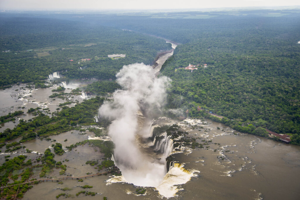
The Río de la Plata system has an average flow rate of 23,000 m³/s. However, taking the Paraná River as an example, it “has an average slope of 5 cm/km over its 2100 km. In its last 100 km before reaching the Río de la Plata estuary, this slope decreases to only 4 mm/km, carrying its waters to the estuary at a speed of 1.3 knots/h (2.5 km/h),” and the Gran Pantanal region in the upper basin of the Paraguay River, a swampy region covering approximately 400,000 km², where the waters stagnate, delaying their flow; these cases indicate that the movement of the waters is not so much due to gravity, but to a convection process (horizontal thermodynamic movement) of solar energy transfer from wetlands, marshes, and unstable coasts, towards the main channels, with enough power to be injected into the vast waters of the Atlantic. Part of this power is harnessed by the hydroelectric industry, which supplies 25% of Brazil’s energy needs and 50% of its industrial system’s, and 40% of Argentina’s.
Land, food, production/reproduction
Continental basin and global projects
World, sphere, planet
Post-global world and the paradigm of composition
New relationships between parts and the whole
This project is possible thanks to: